The Hillfort
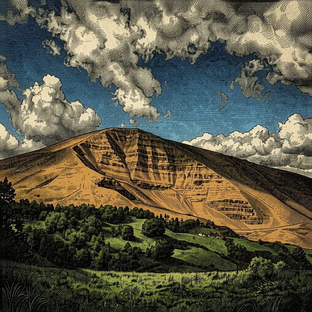
The summit is ringed by the ditch and rampart of a late Bronze Age and early Iron Age hillfort, enclosing some sixteen acres within a double rampart that, when intact, ran to roughly 1,200 yards in circumference — among the largest and earliest hillforts anywhere in the southern Pennines. Two Bronze Age bowl barrows sit within the enclosure, and excavations by the University of Manchester between 1965 and 1969 recovered radiocarbon dates suggesting occupation from around 1200–1000 BC, making Mam Tor one of the earliest defended hilltop settlements yet identified in the region. The fort's southern end carries the only certain original entrance, protected by a third bank; on its eastern side, the ramparts simply stop, swallowed by the same landslide that gives the hill its nickname.
The Battle of Hope, 926 AD (Saga Lore)
Within the Aethereal Stories universe, Mam Tor is given a second, entirely fictional history layered onto its real one. The saga fixes the founding of Hope's End — the invented village on the plateau immediately west of the summit — to the aftermath of a battle fought here in 926 AD, during King Æthelstan's northern campaign against a coalition of Scots, Strathclyde Britons and Hiberno-Norse Vikings. The engagement, remembered in the saga's own Peak District folklore as the Battle of Hope, was fought on the valley floor below the twin peaks of Win Hill and Lose Hill — the same ridge Mam Tor anchors at its western end — with the coalition's main force encamped on Lose Hill itself.
The plateau west of Mam Tor was the battle's geographical key. Æthelstan's commanders assigned its garrison two tasks: to block the only route by which the coalition could be reinforced from the west, through the passes linking the central Peak to the Cheshire plain, and to hold the head of Winnats Pass — the sole escape route open to the Lose Hill army if the battle went against it. To hold the plateau was to close the western gate.
The battle itself was a West Saxon victory. The Lose Hill army broke and fled west, funnelled by the ground into Castleton and then up into the narrow limestone cleft of Winnats Pass, climbing under fire toward what they believed was open moorland at the top. The garrison on the plateau was waiting for them. Caught between Æthelstan's pursuing force at the gorge's eastern mouth and the garrison blocking its western head, the fleeing army was bottlenecked and, by the saga's own chronicler's account, destroyed there in full. Hope's End originates, in this invented history, as the permanent garrison post established on the plateau afterward, to make sure the western route out of the valley could never be reopened by a future hostile force — a settlement whose entire original purpose, in the most literal sense the saga's naming allows, was to make sure nothing that broke on the valley floor could ever get past it and out.
The Landslide & the Lost Road
The landslide that has slowly eaten the hillfort's eastern defences is a genuinely enormous geological event: a rotational slip that began roughly 4,000 years ago, in the Bronze Age, and has never fully stabilised since. Weak shale beneath a harder capping of sandstone gives way under its own saturation after wet weather, and the resulting mass movement has produced a backscarp some 80 metres high feeding a debris flow over 1,000 metres long and up to 450 metres wide — more than 3 million cubic metres of hillside, by some estimates, in slow but continuous motion.
The Sheffield Turnpike Company built the original road across this ground in 1819, using spoil excavated from the nearby Odin Mine, and it required constant repair from the very start. The road was restricted to single-lane working after a serious movement in 1977, and was finally closed for good in 1979 after 160 years of increasingly futile maintenance; the section between Sheffield and Castleton was renumbered the A6187, and the broken, tilted remains of the old carriageway across the landslide are still visible — and still slowly deforming — today.
The Show Caves
The limestone at the foot of the hill has been worked for minerals since at least the Roman period, and four show caves now open to the public sit at or near its base: Blue John Cavern and Treak Cliff Cavern, both worked since the seventeenth century for Blue John, a rare banded purple-blue variety of fluorite found in commercially significant quantities almost nowhere else on earth; Speedwell Cavern, reached by an underground boat trip along a flooded former lead-mine level; and Peak Cavern, whose vast natural entrance once sheltered a working rope-making community inside the hillside itself. Between them, the four caves preserve one of the most complete pictures anywhere in Britain of how thoroughly this single hillside has been mined, walked and lived inside.
Role in the Saga — Cambion spoilers
Covers a quietly significant scene late in the book.
Mam Tor is glimpsed twice at a distance before it is ever properly visited. In Chapter Forty: Every Breath You Take, Robert makes out its dark shoulder against the pre-dawn sky from his window; Toby calls it “the shivering mountain,” the text notes, without any real drama — the way you name something you have lived beside long enough to stop fearing. In Chapter Fifty-One: Here Comes the Rain Again, it recurs mid-chapter as one detail in a wider winter landscape, its summit carrying snow alongside Kinder Scout's while the valley floor below sits merely damp and grey.
That same chapter closes with the hill's only real scene. On New Year's Eve, after the rest of the household has gone to bed, Toby climbs alone to the Shivering Mountain, to a boulder marked only by lichened grooves — a landmark, the text says, known to him and no one else. He unfastens the watch he has worn on his wrist throughout the entire book: his and Ben's late mother's watch, its square face always cold against his skin, its hands frozen and “pointing to the wrong time entirely” ever since she left it to him.
Toby places the watch inside an old, cracked leather case lined in silk and faded blue velvet, kneels, and buries it deep in the peat, smoothing the surface until no trace of the digging remains. The saga does not spell out why now, on this particular night, rather than any other; it offers only Toby's own description of what he feels afterward — not peace, he is careful to note, but the steadiness of a man who has done a necessary thing in the dark, and who knows that necessary things have a way of becoming necessary again. He waits on the hillside until the cold reaches bone, then starts back down toward the valley lights, the matter unresolved on the page and, as far as the text goes, never raised again.
Trivia
- Current movement on the landslide averages around a quarter of a metre a year, accelerating sharply after wet winters — meaning the hill is, quite literally, a slightly different shape today than it was when the old A625 was first abandoned in 1979.
- The hillfort's original entrance, at the southern end behind a triple rampart, is the only one archaeologists are confident was part of the fort's design rather than a later breach opened up by the landslide itself.
- Blue John, mined at the foot of the hill for over three centuries, occurs in economically workable quantities in only one other confirmed location in the world, making Mam Tor's deposits genuinely irreplaceable rather than merely picturesque.
Appearances
| Title |
Role |
Notes |
Cambion
Book One · Book of Thoth Saga |
Scene setting & background scenery |
Glimpsed at a distance in Chapter Forty: Every Breath You Take and mid-way through Chapter Fifty-One: Here Comes the Rain Again; the setting, at that same chapter's close, of Toby Knight's solitary burial of his mother's watch. |